An Introduction to Pangeo

LP / ORNL DAAC UWG 2019
Talk Agenda
- What is Pangeo?
- Why Pangeo?
- How do I use it?
- How can I contribute to it?
"How do I as a scientist use these technologies to advance my data workflows?"
- Aaron Friesz
What is Pangeo?
- Not a software distro, package, or library
- Community of data users and software developers
- Frequently used packages (Pangeo "stack")
- Curated set of tools, architectures, and methodologies
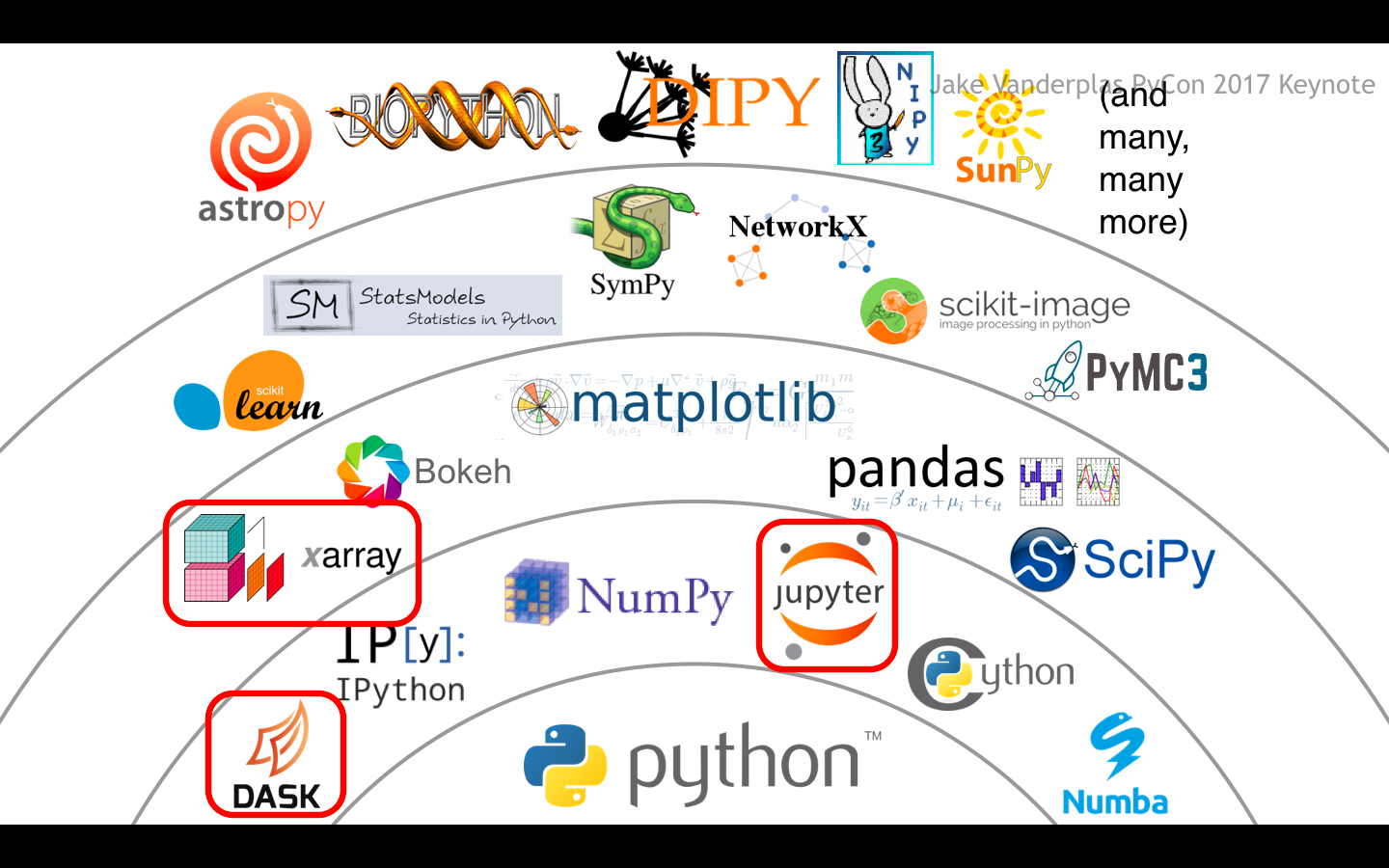
Image Source: Jake VanderPlas, "The State of the Stack," SciPy Keynote (SciPy 2017).
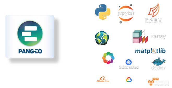
Image Source: Theo McCaie, UK Met Office, ESA Φ-week Event.
Goal:
Foster collaboration around open source scientific python ecosystem for ocean / atmosphere / climate science
Goal:
Build out stack with domain specific packages (e.g. thermodynamics, regridding, vector calculus, etc)
Goal:
Scale to handle many-PB data missions (e.g. SWOT, NISAR)
EOSDIS Data Ingest Rates
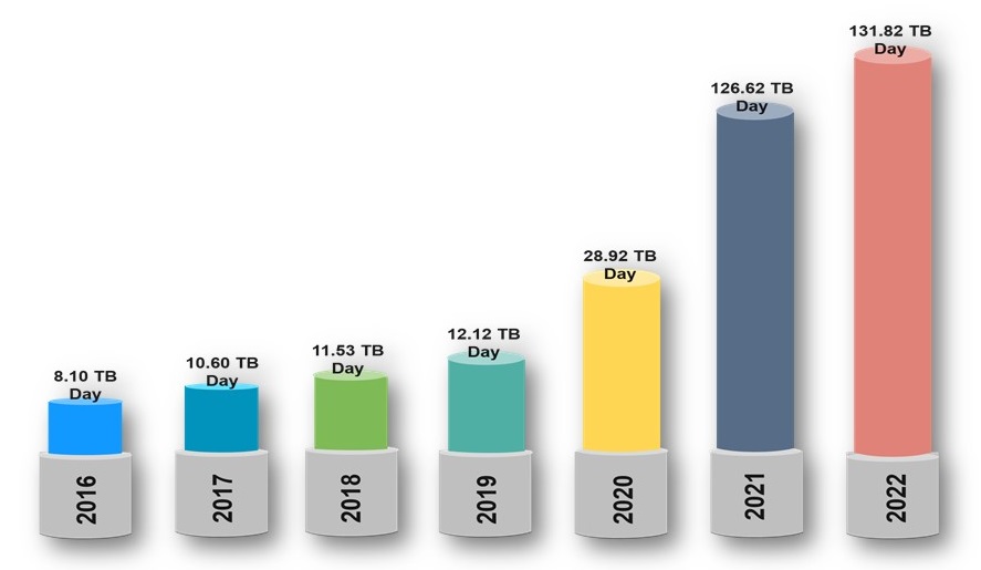
Image Source: https://earthdata.nasa.gov/about/cloud-evolution
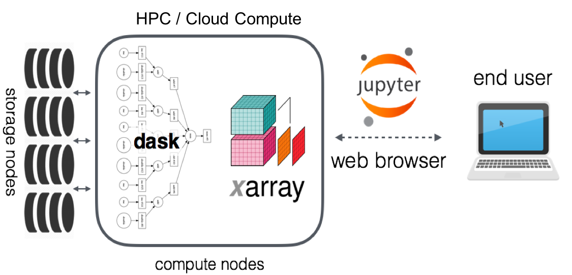
Image Source: Pangeo Technical Architecture (https://pangeo.io/architecture.html)
- No source data downloaded to workstation
- Well suited for cloud-native data stores/formats (e.g. S3, GCS and COGs, Zarr)
- Notebooks can be persisted, shared
- Compute is ephemeral
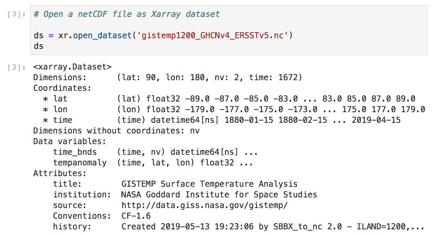
Xarray
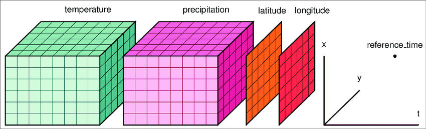 http://xarray.pydata.org/en/stable/api.html
Xarray
Dask
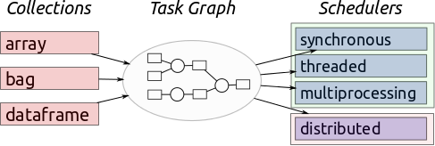
Image Source: Multidimensional Arrays, Geohackweek 2016
Dask
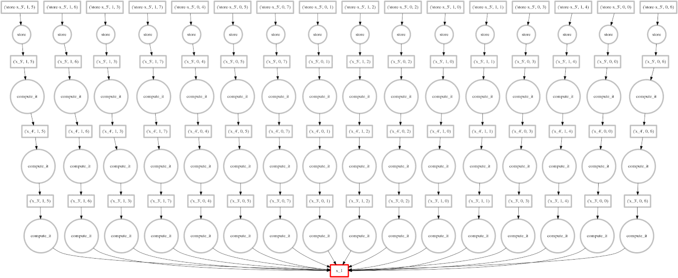
Image Source: Multidimensional Arrays, Geohackweek 2016
Cloud-Native Data Formats
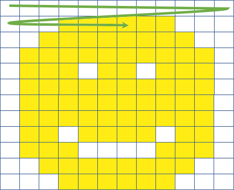
Image Source: James Norton (Element 84)
Cloud-Native Data Formats
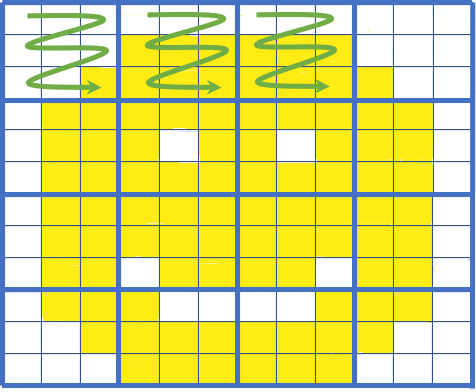
Image Source: James Norton (Element 84)
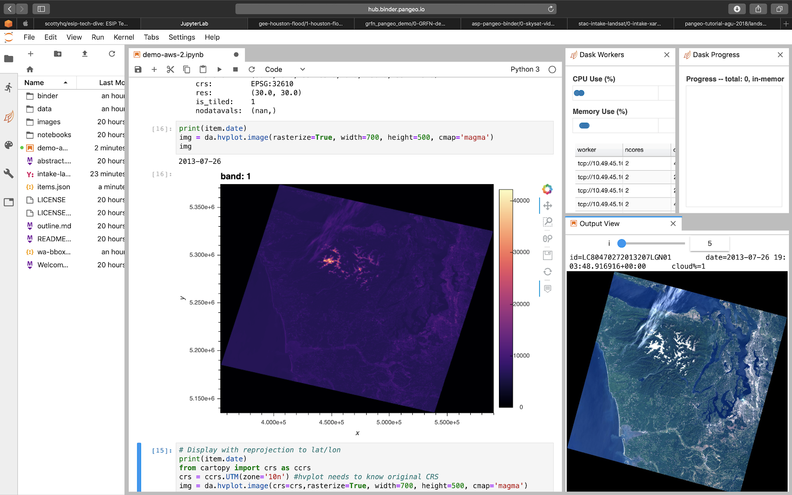
Image Source: Scott Henderson (University of Washington)
Demo?
https://nasa.pangeo.ioDeploying Pangeo
- Deploy Kubernetes Cluster
- Configure with Pangeo-provided settings file
- Deploy Pangeo-provided Helm chart
Further Resources
- Website: http://pangeo.io/
- Github: https://github.com/pangeo-data
- Blog: https://medium.com/pangeo
- Gitter: https://gitter.im/pangeo-data
Thank you.
(Come see Pangeo talks at AWS PSS, ESIP!)
andrew@element84.com
apawl.com/talks/pangeo-lp-ornl.htmlBackup Slides
Using Your Deployment: Dask
from dask_jobqueue import PBSCluster
from dask.distributed import Client

cluster = PBSCluster(cores=36,
										 memory="108GB")
cluster.scale(10)
client = Client(cluster)
Using Your Deployment: Dask
from dask_kubernetes import KubeCluster
from dask.distributed import Client

cluster = KubeCluster(n_workers=10)
cluster.scale(10)

client = Client(cluster)
Cloud Optimized GeoTIFFs (COGs)
- Regular GeoTIFFs
- Tiled
- Support HTTP GET Range Requests
- End users download subset range of the GeoTIFF
Zarr
- Multi-dimensional arrays saved in discrete chunks
- Each chunk is a file
- Clients can pull only the chunks they need